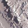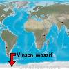

Satellite image of Vinson Massif. Tags: Vinson Massif View |
Tags: Vinson Massif View |
Tags: Vinson Massif View |
|||||||||
Vinson Massif (pron-en?v?ns?n m�?si?f) is the highest (Extremes of Altitude) mountain of Antarctica, located about 1,200 km (750 mi) from the South Pole. The mountain is about km to mi21abbr=on long and km to mi13abbr=on wide. At convert4892mft0 the highest point is Mount Vinson, which was named in 2006 by US-ACAN (Advisory Committee on Antarctic Names). The southern end of the massif ends at Hammer Col, which joins it to the Craddock Massif, of which the highest point is Mount Rutford (4477 m).
The massif lies in the Sentinel Range of the Ellsworth Mountains, which stand above the Ronne Ice Shelf near the base of the Antarctic Peninsula.
A high mountain, provisionally known as Vinson was long suspected to be in this part of West Antarctica, but it was not actually seen until January 1958, when it was spotted by US Navy aircraft from Byrd Station. It was named after Carl Vinson (also the namesake of an aircraft carrier (USS Carl Vinson (CVN-70))), a United States Georgia (Georgia (U.S. state)) Congressman who was a key supporter of funding for Antarctic research.
Photo Caption: NASA image of Vinson Massif from space
Elevation M: 4892
Prominence M: 4,892
Prominence Ref: Ranked 8th (List of peaks by prominence)
Map: Earth
Map Size: 350
Listing: Seven summits, Ultra (Ultra prominent peaks)
Birth Location: Antarctica (British Antarctic Territory)
Range: Sentinel Range
Lat D: 78 lat_m = 31 lat_s = 31.74 lat_NS = S
Long D: 85 long_m = 37 long_s = 1.73 long_EW = W
Region: AQ
First Ascent: 1966 by Nicholas Clinch and party
Easiest Route: snow/ice climb


