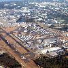

recolor & unsharp mask Tags: Paine Field View |
Tags: Paine Field View |
Tags: Paine Field View |
|||||||||
Paine Field, also known as Snohomish County Airport Airport codesPAEKPAE is a public airport located in unincorporated Snohomish County, between Mukilteo (Mukilteo, Washington) and Everett (Everett, Washington), Washington (Washington (U.S. state)). It is served by a Federal Aviation Administration control tower, and has precision and non-precision instrument approaches available to pilots.
Iata: PAE
Icao: KPAE
Type: Public Airport Department
Operator: Snohomish County (Snohomish County, Washington)
Birth Location: Snohomish County, Washington
Elevation-f: 606
Elevation-m: 184.7
Coordinates: Coord475422N1221653Wtype:airportdisplay=inline,title
Number on List: 16R/34L
R1-length-f: 9,010
R1-length-m: 2,746
R1-surface: Asphalt/Grooved
Number on List: 11/29
R2-length-f: 4,504
R2-length-m: 1,373
R2-surface: Asphalt
Number on List: 16L/34R
R3-length-f: 3,000
R3-length-m: 914
R3-surface: Asphalt


