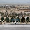

An aerial view of Kandahar International Airport in southern Afghanistan. Tags: Kandahar International Airport View |
Kandahar International Airport (more commonly known as Kandahar Airport) Airport codesKDHOAKN is located 10 miles (16 kilometers) south-east of Kandahar City (Kandahar) in Afghanistan. The airport was built by the United States in the 1960s, under the United States Agency for International Development program. It may have been intended to be used as a possible U.S. military base in case the United States and former USSR went into war. It was occupied by the Soviets in 1979, and was severely damaged during the 1980s Soviet war in Afghanistan. It received further damages again during October 2001 Operation Enduring Freedom when the Taliban government was being toppled.
As of 2007, Kandahar Airport has been rebuilt and is used for both military and civilian flights. At first it was mainly occupied by the United States armed forces but since 2006 the airfield has been maintained by the Canadian Forces. There are also other forces present from the International Security Assistance Force (ISAF) (International Security Assistance Force). It is sometimes difficult to locate the airport from the sky during day-time because of lack of contrast with the ground and the usual dust or haze in the area. But during night the runway is well lit up and can easily be spotted because it is isolated from the population area.
Iata: KDH
Icao: OAKN
Type: Public/military
Owner: Government of Afghanistan (Politics of Afghanistan)
Operator: Canadian Forces/US Air Force/Royal Air Force/NATO
City-served: Kandahar City (Kandahar)
Birth Location: Kandahar Province
Elevation-f: 3,330
Elevation-m: 1,015
Coordinates: Coord313021N655052E region:AF_type:airport display=inline,title
Number on List: 05/23
R1-length-f: 10,498
R1-length-m: 3,200
R1-surface: Paved

