Tags: Hurricane Daniel View |
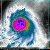
about the same timeframe 2200Z and 0200Z 5pm and 9pm CDT show the large increase in cirrus radiating outward from the edges of the storm and the increase in the size of the convection A water vapor image from 0230Z 9 30pm CDT shows again just how symmetric and deep the convection is around the center and how the eye has warmed Tags: Hurricane Daniel View |
This GOES RGB satellite image was from 1530Z 10 30am CDT Image courtesy of NOAA SSD More detail can be seen on this GOES 11 Visual image from 1830Z 1 30pm CDT Image courtesy of NOAA SSD obtained from the NRL web site The stadium effect can clearly be seen in the large Tags: Hurricane Daniel View |
|||||||||