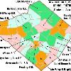

Map of Berks County, Pennsylvania, United States Public School Districts Tags: Boyertown Area School District View |
Tags: Boyertown Area School District View |
Tags: Boyertown Area School District View |
|||||||||
The Boyertown Area School District spans portions of two counties. In Berks County, Pennsylvania it covers the Boroughs of Bally (Bally, Pennsylvania), Bechtelsville (Bechtelsville, Pennsylvania) and Boyertown (Boyertown, Pennsylvania) and Colebrookdale Township (Colebrookdale Township, Berks County, Pennsylvania), Douglass Township (Douglass Township, Berks County, Pennsylvania), Earl Township (Earl Township, Berks County, Pennsylvania) and Washington Township (Washington Township, Berks County, Pennsylvania). In Montgomery County, Pennsylvania it covers Douglass Township (Douglass Township, Montgomery County, Pennsylvania), New Hanover Township (New Hanover Township, Montgomery County, Pennsylvania) and Upper Frederick Township (Upper Frederick Township, Montgomery County, Pennsylvania). The district educates about 7,000 students in ten schools. When the Boyertown Area School District was formed in 1953 it was one of the largest in the state, encompassing 100 square miles.
Streetaddress: 911 Montgomery Avenue
City: Boyertown
State: Pennsylvania
County: Berks, Montgomery
Zipcode: 19512
Superintendent: Dion E. Betts, Ed.D.
Teaching Staff: 424.7 (on FTE (full-time equivalent) basis)
Ratio: 16.4
Type: Public
Enrollment: 6,979 (2005-2006)
Grades: K-12
Mascot: Bears
Homepage:


