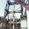

Taken from llnl.gov, this is a photo of preparations for the Cannikin nuclear test. Since it was produced by a US federal government employee, it should be copyright-free. Tags: Amchitka View |
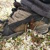
Image credit Photo by Wolfgang Soyer UAF Filename WS IMG 0157 JPG Rommel spikes buried in the ground on Amchitka Island were a serious hazard for hikers The spikes are left over from American fortifications placed during World War II when Japanese Tags: Amchitka View |
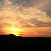
The first evening on Amchitka brought a spectacular Aleutian sunset Credit Photo by Anna Forsstrom UAF Filename AF Amchitka 077 jpg Tags: Amchitka View |
|||||||||
Amchitka (pronEng�m?t??tk?; Amchixtax? in Aleut (Aleut language)) is a volcanic, tectonically (plate tectonics) unstable island in the Rat Islands group of the Aleutian Islands in southwest Alaska. It is about convert68kmmi0sp=us long, and from convert3to6kmmi1abbr=on wide. It has a maritime climate, with many storms, and mostly overcast skies.
The island was populated for more than 2,500 years by the Aleut people, but has had no permanent population since 1832. It was included in the Alaska Purchase of 1867, and has since been part of the United States. During World War II, it was used as an airfield by US forces in the Aleutian Islands Campaign.
Amchitka was selected by the United States Atomic Energy Commission to be the site for underground detonations (nuclear testing) of nuclear weapons. Three such tests were carried out: Long Shot, an convert80kt(TNT)sp=usadj=onlk=on blast in 1965; Milrow, a convert1Mt(TNT)sp=usadj=on blast in 1969; and Cannikin in 1971 - at "under" convert5Mt(TNT)abbr=on, the largest underground test (underground nuclear testing) ever conducted by the United States. The tests were highly controversial, with environmental groups (environmentalism) fearing that the Cannikin explosion, in particular, would cause severe earthquakes and tsunamis. Amchitka is no longer used for nuclear testing, although it is monitored for the leakage of radioactive materials (radioactive contamination).
Map: Image:AmchitkaAlaskaLoc.png
Map Caption: Location of the site
Type: Nuclear testing range
Coordinates: Coord513026.78N179232.98Escale:500000_region:US-AK_type:landmarkname=Amchitka Underground Test Site
Operator: United States Department of Energy
Dates: 1965-1971
Remediation: 2001-2025 (DoE estimate)
Thermonuclear Tests: 3


