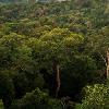

Changes include enhanced color, cropped out extraneous sections, enhanced distracting parts, and other general enhancements. Tags: Amazon Rainforest View |
Amazon rainforest (in Portuguese (Brazilian Portuguese), Floresta Amaz�nica or Amaz�nia; lang-esSelva Amaz�nica or Amazonia), also known as Amazonia or Amazon jungle, is a moist broadleaf forest (Tropical and subtropical moist broadleaf forests) that covers most of the Amazon Basin of South America. This basin encompasses seven million square kilometers (1.7 billion acres), of which five and a half million square kilometers (1.4 billion acres) are covered by the rainforest. This region includes territory belonging to nine nations. The majority of the forest is contained within Brazil, with 60% of the rainforest, followed by Peru with 13%, and with minor amounts in Colombia, Venezuela, Ecuador, Bolivia, Guyana, Suriname and French Guiana. States or departments in four nations bear the name Amazonas (Amazonas (disambiguation)) after it. The Amazon represents over half of the planets remaining rainforests, and it comprises the largest and most species-rich tract of tropical rainforest in the world.
The Amazon rainforest was short-listed in 2008 as a candidate to one of the New7Wonders of Nature by the New Seven Wonders of the World Foundation. As of February 2009 the Amazon was ranking first in Group E, the category for forests, national parks and nature reserves.
Parent: South America
River: Amazon River
Highest Location: highest_region = highest_state =
Highest Lat D: highest_lat_m = highest_lat_s = highest_lat_NS =
Highest Long D: highest_long_m = highest_long_s = highest_long_EW =
Lowest Location: lowest_region = lowest_country =
Lowest Lat D: lowest_lat_m = lowest_lat_s = lowest_lat_NS =
Lowest Long D: lowest_long_m = lowest_long_s = lowest_long_EW =
Length: length_orientation = N/S
Area: 5500000
Population: population_date =
Free: free_type =
Map: Amazon rainforest.jpg
Map Caption: Map of the Amazon rainforest ecoregions as delineated by the WWF (world Wide Fund for Nature). Yellow line approximately encloses the Amazon drainage basin. National boundaries shown in black. Satellite image (Satellite imagery) from NASA.
Footnotes: The

